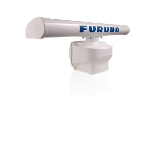



Furuno’s DFF3D takes 3D Fish Finding to new depths. We’re talking depths of over 980 feet, with Side Scanning over 650 feet. See fish and bottom structure as you’ve never seen them before, at depths previously unfathomable. Now you can visibly see fish schools and the underwater landscape at great depths in amazing detail. The DFF3D turns your NavNet TZtouch, TZtouch2, or TZtouch3 MFD into a Multibeam Sonar that can see 120-degrees port to starboard, allowing you to see the depth and direction fish schools are moving, while displaying the seabed condition in real time.
Cross section displays the real-time sea column echo in 120 degrees port and starboard. This mode aids in instantly understanding the distribution of bait fish and the water column condition, with a detection range of over 650 feet, depending on bottom, water and installation conditions.
The 3D sounder history provides an intuitive and easy to understand 3D image of the seafloor, along with fish school icons. This mode is useful in a variety of situations, such as selecting a fishing hot spot and assessing the seabed condition.
A single (directly under boat) or triple direction (middle, left and right) fish finder image are displayed simultaneously. The Triple beam display helps to understand the depth of fish targets and the seabed condition in each direction, as well as the direction the target fish are moving. Each beam angle and beam width are selectable.
Side scan clearly displays the shape of structure as a high definition image in port and starboard direction. It is suitable for searching the seabed and understanding the sea floor structure. The sidebar detection range is over 650 feet in a 120-degree swath port to starboard, a distance you've never seen before!
Using the DFF3D Multibeam Sonar, PBG (Personal Bathymetric Generator) allows you to create custom high-resolution shaded relief charts of the seafloor. Bottom images are drawn with shaded relief, depth contours, and variable colors, making it easy to identify hidden structure and ridges that hold fish in a simple, easy-to-interpret presentation. Multiple color palettes are available, including the ability to show contour lines only. The area each ping covers is approximately twice the depth at the time of recording, so at a depth of 100 meters, a 200 meter-wide area is displayed and recorded to your NavNet TZtouch3 or TZtouchXL MFD or NavNet TZtouch2 TZT2BB.
| SPECIFICATIONS | |
| Display Size | Supplied Separately |
| Display Type | Supplied Separately |
| Frequency | 165 kHz |
| Power Usage | 12-24 VDC |
| Range | 300 m down - 200 m sidebar |




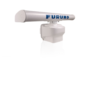
Furuno’s DFF3D takes 3D Fish Finding to new depths. We’re talking depths of over 980 feet, with Side Scanning over 650 feet. See fish and bottom structure as you’ve never seen them before, at depths previously unfathomable. Now you can visibly see fish schools and the underwater landscape at great depths in amazing detail. The DFF3D turns your NavNet TZtouch, TZtouch2, or TZtouch3 MFD into a Multibeam Sonar that can see 120-degrees port to starboard, allowing you to see the depth and direction fish schools are moving, while displaying the seabed condition in real time.
Cross section displays the real-time sea column echo in 120 degrees port and starboard. This mode aids in instantly understanding the distribution of bait fish and the water column condition, with a detection range of over 650 feet, depending on bottom, water and installation conditions.
The 3D sounder history provides an intuitive and easy to understand 3D image of the seafloor, along with fish school icons. This mode is useful in a variety of situations, such as selecting a fishing hot spot and assessing the seabed condition.
A single (directly under boat) or triple direction (middle, left and right) fish finder image are displayed simultaneously. The Triple beam display helps to understand the depth of fish targets and the seabed condition in each direction, as well as the direction the target fish are moving. Each beam angle and beam width are selectable.
Side scan clearly displays the shape of structure as a high definition image in port and starboard direction. It is suitable for searching the seabed and understanding the sea floor structure. The sidebar detection range is over 650 feet in a 120-degree swath port to starboard, a distance you've never seen before!
Using the DFF3D Multibeam Sonar, PBG (Personal Bathymetric Generator) allows you to create custom high-resolution shaded relief charts of the seafloor. Bottom images are drawn with shaded relief, depth contours, and variable colors, making it easy to identify hidden structure and ridges that hold fish in a simple, easy-to-interpret presentation. Multiple color palettes are available, including the ability to show contour lines only. The area each ping covers is approximately twice the depth at the time of recording, so at a depth of 100 meters, a 200 meter-wide area is displayed and recorded to your NavNet TZtouch3 or TZtouchXL MFD or NavNet TZtouch2 TZT2BB.
| SPECIFICATIONS | |
| Display Size | Supplied Separately |
| Display Type | Supplied Separately |
| Frequency | 165 kHz |
| Power Usage | 12-24 VDC |
| Range | 300 m down - 200 m sidebar |